
 (C:)
(C:) profile
 AgentProvenance
Spatial data · Visual workflows · LLM assistance
UrbanTrace: LLM-Assisted Discovery and Integration of Spatial Data
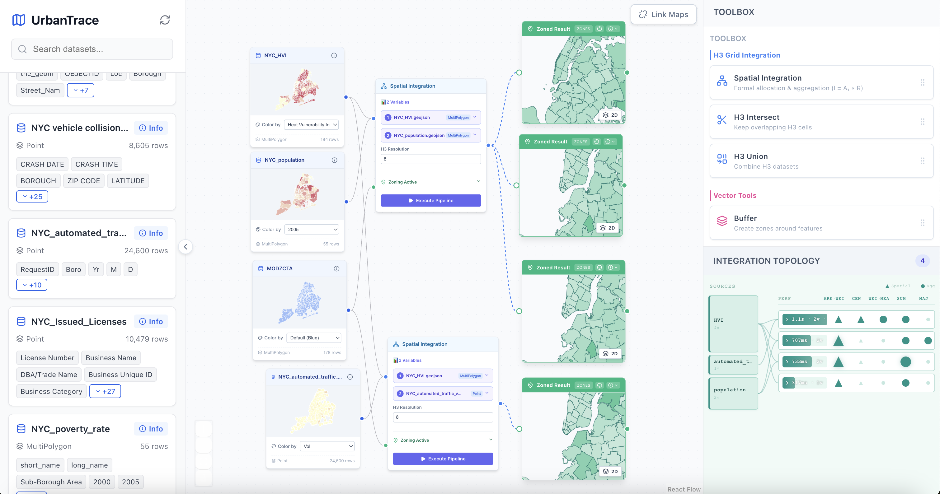
UrbanTrace is a node-based environment for building transparent spatial data workflows—from finding relevant urban datasets to combining and analyzing them on a map.
From question to spatial workflow
Urban analysis often requires discovering datasets across different portals, understanding unfamiliar schemas, and chaining spatial operations. UrbanTrace brings those steps into one visual canvas where intermediate data and operations remain explicit.
A spatial analysis canvas
- A searchable data library exposes GeoJSON datasets and their metadata.
- React Flow provides an infinite canvas for arranging sources and operations.
- Deck.GL mini-maps show choropleth and geometry previews directly inside each node.
- Resizable operation nodes execute Buffer, Intersection, Join, H3 Union, and H3 Intersect workflows.
- An integration-topology view summarizes how sources contribute to derived outputs.
Live spatial computation
The FastAPI backend converts geometries to H3 cells for deterministic union and intersection operations. Results can be viewed as flat density maps or extruded 3D surfaces, with contextual legends calculated from overlap counts. Processing overlays and node-level results keep execution feedback close to the operation that produced it.
Integration Copilot
The “Ask AI” assistant uses dataset metadata and geometry context to recommend zoning and aggregation operators. Grid operations stay deterministic in the interface, keeping the model in an advisory role while the analytical steps remain visible and reproducible.
React · Vite · React Flow · Deck.GL · H3 · FastAPI · GeoJSON
All rights reserved 